Hot Weather In The Forecast – Important Safety Reminders For The Hood River Waterfront Areas
July 19, 2022
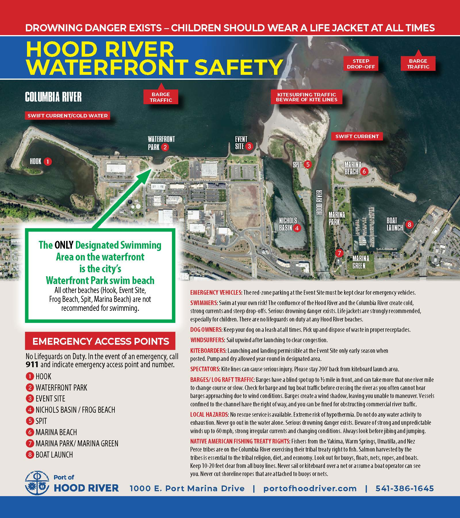
With warm weather in the forecast for the coming days, it’s important to remember the following when recreating at the Hood River Waterfront.
- The only designated swimming area on the Hood River waterfront is the Waterfront Park.
- Serious drowning danger and natural hazards exist in the waters of the Columbia River and the Hood River.
- The waters of the Columbia are still quite cold and the waters of the glacially-fed Hood River are very cold.
- There are very strong currents, undertows and steep drop offs, especially at the edges of sandy areas near the confluence of the Hood River with the Columbia. The Spit and Sandbar look like peaceful, flat beaches, but they are moving, dynamic sediment deposits and serious drowning danger exists.
- Children should be directly supervised by a parent or caregiver at all times near the water. Lifejackets are strongly recommended.

- There are NO Lifeguards or any other dedicated professional rescue service on any beaches in Hood River.
- Dogs MUST BE ON LEASH, attached to their humans at all times on Port properties.
- Kiteboarding is a sport that requires lots of clearance to enjoy safely. Spectators and other users are urged to stay upwind and far away from kiteboarding launch and land areas.
- Campfires and bonfires are not allowed on any Port property.
- Underwater hazards exist at the Nichols Basin sea wall and the pilings along the waterfront. No jumping or diving from the sea wall or the pilings is allowed.
In 2017, the Port and its partners in the Columbia Gorge Windsurfing and Kiteboarding Associations (now CGW2) and Hood River Fire & EMS developed the Hood River Waterfront Safety Zones map. This map identifies several known safety hazards and also numbered areas that can be used to communicate location quickly to emergency dispatch personnel. Please view and download the map here to familiarize yourself with the area, but remember, conditions are constantly changing and new hazards may now exist.